Buenos Aires by the Block: How to Read Argentina’s Capital
From the steps of the Cabildo on Plaza de Mayo, the pink front of the Casa Rosada sits across the square to the east, and the river it was built to face is nowhere in sight. Turn around and Avenida de Mayo runs dead straight west under its iron balconies toward the green dome of Congress. This is where the grid begins, and once you understand how it counts, you’ll rarely need a map.
How Buenos Aires Is Laid Out
Buenos Aires is flat, enormous and almost entirely a grid. The Río de la Plata lies along its eastern edge, but the city mostly turns its back to it; between the old center and the water there’s a strip of former docks, Puerto Madero, and then a long band of reclaimed land. You’ll orient by plazas and avenues, not by the river.
The key is the block. A standard city block (a cuadra) is about 100 m, and street numbers go up by 100 with each one. So Defensa 1000 is ten blocks from where Defensa starts, and if you’re at 400 and need 1300, that’s nine blocks, roughly a 12-minute walk. This works across most of the city and turns every address into a distance.
The barrios a visitor needs fall into a rough fan around Plaza de Mayo:
- Monserrat and the Microcentro, right around the plaza: government buildings, offices, and Avenida de Mayo running west.
- San Telmo, directly south: the oldest residential quarter, with cobbled streets, antique shops and the Sunday fair.
- La Boca, further south and east, where the Riachuelo meets the river.
- Retiro and Recoleta, to the north: the grand early-20th-century city of mansions, embassies and the famous cemetery.
- Palermo, northwest of Recoleta: parks, lakes and the city’s biggest dining and nightlife district.
Running through the middle is Avenida 9 de Julio, a north–south boulevard so wide that crossing it takes a couple of light cycles, with the Obelisco at its intersection with Corrientes. The Subte (metro) radiates out from the center: Line A runs under Avenida de Mayo, Line D heads northwest toward Palermo, Line E goes southwest, and Line C links the two big rail terminals, Retiro in the north and Constitución in the south.
Where to base yourself
I’d stay at the seam between Monserrat and San Telmo, a few blocks south of Avenida de Mayo. You can walk to Plaza de Mayo in five minutes and to San Telmo’s Plaza Dorrego in ten, and three Subte lines (A, C and E) are within a short walk, so Recoleta and Palermo are easy rides north. Palermo is the more popular choice, and it’s pleasant, but from there everything historic is a ride away; from here, it’s a walk.
Routes
Route 1: Avenida de Mayo, Plaza to Congress
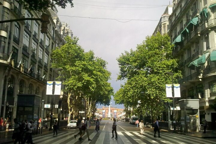
Start in Plaza de Mayo, with the Casa Rosada at its eastern end, the Metropolitan Cathedral on the north side and the white colonial Cabildo on the west. Then walk west down Avenida de Mayo, the city’s first grand boulevard, opened in the 1890s with Madrid and Paris in mind.
It’s a flat, straight walk of about 1.5 km (0.9 mi), 20–25 minutes without stops, but you’ll stop. The buildings are the attraction: Art Nouveau facades, old hotels, and wrought-iron balconies one above another. At number 825, Café Tortoni, open since 1858, is the city’s most famous old café; expect a line at the door at busy times. Further along, past 9 de Julio, the Palacio Barolo rises at number 1370, an office tower from the 1920s with a lighthouse at its top.
The avenue ends at the Plaza del Congreso, facing the domed Congress building. Line A runs directly underneath the whole walk, so if your feet give out you can ride back from Congreso to Perú or Plaza de Mayo station in a couple of minutes.
Route 2: South Down Defensa to San Telmo
From the southeast corner of Plaza de Mayo, walk south on Defensa, which runs straight through the old city. The pavement turns to cobblestones and the buildings drop to two and three stories, many with deep entry halls and courtyards (some of these old conventillos, tenements, are now arcades and markets).
About 1.1 km (0.7 mi) from the plaza, roughly the 1000 block, you reach Plaza Dorrego, the heart of San Telmo, and one of the few fully paved squares in the city. The Feria de San Telmo, the antiques fair that started here in 1970, runs every Sunday and spreads for blocks up Defensa with stalls of silverware, old soda siphons, records and crafts, plus tango dancers on the corners.
Keep going south on Defensa another 800 m (0.5 mi) or so to Parque Lezama, a hilly, tree-shaded park on the old riverbank bluff; it’s the one place in central Buenos Aires where the ground actually slopes. The walk from Plaza de Mayo to the park is about 2 km (1.2 mi), and it takes most of a Sunday morning with the fair. If you want to continue to La Boca and the painted houses of Caminito, take a bus or a ride-hailing car rather than walking the industrial blocks in between, and stay on the main tourist streets once you’re there.
Route 3: Recoleta to the Palermo Parks
Take Line D from Catedral station (on Plaza de Mayo) to Facultad de Medicina, then walk about 1.2 km (0.75 mi) northeast to the Recoleta Cemetery, a walled city of marble mausoleums laid out in its own grid of narrow streets. Eva Perón’s family tomb draws a crowd; the rest of the cemetery, with its cats and crumbling chapels, is quieter and more interesting. It’s open 9 a.m. to 5 p.m., and foreign visitors need a ticket bought online through the city’s cemeteries website before arriving.
Leave by the main gate, cross the lawns of Plaza Francia, and head northeast across Avenida del Libertador to the Floralis Genérica, a giant steel flower about 700 m (0.4 mi) from the cemetery. From here, follow Avenida Figueroa Alcorta northwest through a long chain of parks for about 3 km (1.9 mi) to the Palermo lakes and the Rosedal, the rose garden on the water. The path is flat and mostly shaded; on weekends, part of the park roads close to cars and fill with runners and cyclists.
To get back, walk southwest about 1 km (0.6 mi) to Plaza Italia station and take Line D back downtown. The whole route is about 6 km (3.7 mi) on foot; give it a half day.
Map Notes
- The Subte takes contactless Visa and Mastercard credit and debit cards, including foreign ones, at the turnstiles marked with the Visa logo; the regular gates take only the SUBE card. A single ride costs 1,817 pesos from October 2026, and you’ll need a SUBE card for city buses.
- Addresses are distances: each block is 100 numbers. Street names change on either side of Avenida Rivadavia, the city’s north–south dividing line, so check which side your address is on.
- From Ezeiza Airport, the Tienda León shuttle runs to its terminal in Puerto Madero, near Retiro, and you take a taxi from there; buy tickets at the booth in arrivals. The public Line 8 bus is much cheaper but takes about an hour and a half, needs a SUBE card and is a squeeze with luggage. For a taxi, use the official booths inside the terminal.
- Do Route 2 on a Sunday for the fair and Route 3 on a weekend, when the park roads close to traffic.
- Crossing 9 de Julio takes two or three light cycles; wait on the medians rather than running for the far side.
The Honest Take
Palermo gets the recommendations, and it’s lovely, but staying there means spending a lot of your trip on the Subte; the old south of the city is where Buenos Aires feels most like itself. What surprised me most was how the grid itself does the navigating for you. My first afternoon, I needed to get from Defensa 400 to a place at Defensa 1300 and was about to hail a cab, convinced it was across town. The man at the corner kiosk, selling me a bottle of water, asked where I was headed, laughed, and held up nine fingers. “Nine blocks,” he said, and pointed south. I walked it in 12 minutes, past the first stalls of the Sunday fair, and never looked at an address the same way again.