One Line, One Day: Lima’s Metropolitano, Cliffs to Cathedral
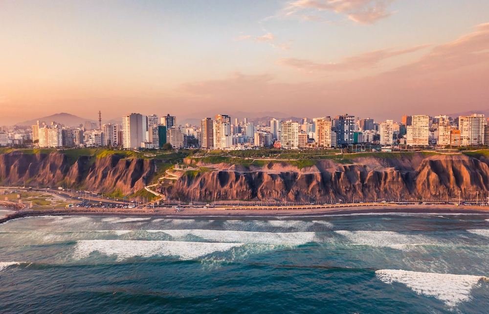
At eight in the morning the sky over Barranco is the flat pearl-gray that Limeños call garúa, and the Pacific below the cliffs is the same color, so the horizon simply disappears. Behind you, a bright red articulated bus pulls into its glass station in the middle of the expressway, heading north. By the end of the afternoon, that same line will have dropped you in front of a 17th-century cathedral.
The Line
Lima is a city on a desert shelf. The modern districts, Barranco, Miraflores and San Isidro, sit along clifftops above the Pacific, while the colonial center is about 10 km (6 mi) inland to the north, near the Rímac River. Most visitors stay by the sea and treat the center as a separate expedition by taxi, through some of the worst traffic in South America.
The Metropolitano, Lima’s bus rapid transit system, solves that. Its buses run in their own lanes down the middle of the Vía Expresa, a sunken highway that cuts through Miraflores and San Isidro, so they skip the traffic above. The trunk line starts at Matellini station in Chorrillos, runs north through Barranco and Miraflores to Estación Central, an underground hub beneath Paseo de los Héroes Navales, and then splits; one branch threads through the historic center at Colmena, Tacna, Jirón de la Unión and Ramón Castilla.
A few things to know before you ride:
- Routes: Regular services stop at every station. Route C is the one you want: it runs between Matellini and Ramón Castilla, straight through Barranco, Miraflores and the center, but only at certain hours. Outside those hours, ride any regular bus north to Estación Central and change there for the center branch.
- Paying: You need a rechargeable Metropolitano card or Lima Pass, sold and topped up at the machines in every station. A trunk-line ride costs S/ 3.20 regardless of distance.
- Hours: Buses run roughly 5 a.m. to 10:30 p.m. on weekdays, with reduced weekend schedules; express services skip stops and run only at peak times, so check the route letter on the bus.
Where to stay: Barranco or southern Miraflores, within walking distance of a Metropolitano station. You get the cliffs and the restaurants outside your door, and the center is a single ride away.
The Day
8:00 — Barranco: The Bridge and the Steps to the Sea
Start in Barranco’s main square, Parque Municipal, and walk a block toward the ocean to the Puente de los Suspiros, a small wooden footbridge from the 19th century. Below it, the Bajada de Baños drops as a shaded stone stairway lined with old houses and bougainvillea, cutting down through the cliff toward the water. Follow it all the way down, about 300 m (0.2 mi), and you come out by the sea, then climb back up.
Barranco’s streets are low, colorful and full of street art; give yourself an hour to wander the blocks between the bridge and Avenida Grau. Most cafés open by 8 or 9, so breakfast is easy to find here.
9:30 — The Stretch to Walk, Not Ride: The Malecón to Miraflores
The first leg of the line is better on foot. From Barranco, walk north along the malecón, the clifftop promenade, into Miraflores. It’s about 3 km (1.9 mi), flat and paved, with the Costa Verde highway and the beaches far below and paragliders launching off the cliff edge on clear days. Allow 45 minutes to an hour.
You’ll pass Parque del Amor, with its mosaic benches and a big sculpture of a kissing couple, and then Larcomar, a shopping center built into the cliff face. From Parque del Amor, turn inland up Avenida Larco, the main shopping street, for about 1.2 km (0.75 mi) to Parque Kennedy, the green heart of Miraflores, famous for the dozens of cats that live in it.
12:00 — Lunch in Miraflores
Miraflores is the easiest place on the line to eat well, especially at lunch, when many restaurants serve a fixed-price menú or a ceviche that’s at its best before the afternoon. The blocks around Parque Kennedy and along Avenida Larco are where you’ll find the widest choice; a ceviche spot for lunch is the classic Lima move.
13:30 — Ricardo Palma Station: Boarding the Line
From Parque Kennedy, walk east along Avenida Ricardo Palma for about 800 m (0.5 mi), 10 minutes, to Ricardo Palma station, where the avenue crosses the Vía Expresa. The station sits in the median of the trench; you go down from street level to reach the platform.
Board a bus heading north. The ride runs below street level through San Isidro, past Angamos, Canaval y Moreyra and Javier Prado, with office towers and overpasses passing above you, until the line reaches Estación Central underground. If your bus ends here, follow the signs inside the station for the center branch toward Colmena.
14:30 — Colmena: Plaza San Martín
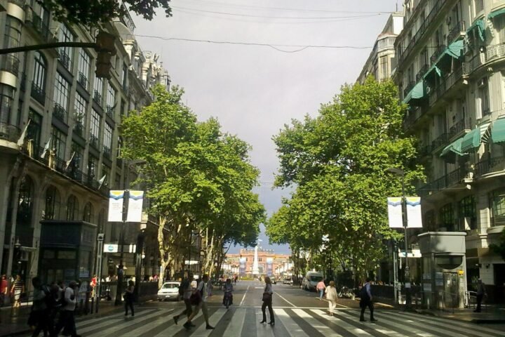
Get off at Colmena and come up onto Plaza San Martín, a grand square ringed by early-20th-century buildings with arcades, with the equestrian statue of the liberator in the middle. This is the start of the old center’s main walking axis.
15:00 — Jirón de la Unión to the Plaza de Armas
From the corner of Plaza San Martín, walk north up Jirón de la Unión, a pedestrian street of shops and old facades, five or six blocks to the Plaza de Armas, about 700 m (0.4 mi). The square is the colonial core of the city: the Cathedral on the east side, the Government Palace on the north, and wooden balconies on the buildings around it.
From the plaza, walk about 350 m (0.2 mi) east to the Basilica and Convent of San Francisco, a yellow-and-white church with a library and cloisters. Beneath it are the catacombs, used as a cemetery until 1810 and holding the remains of around 25,000 people, with bones laid out in geometric patterns. Visits are guided, and photography is discouraged underground.
17:30 — Back South for Sunset
Walk back to Jirón de la Unión station and catch a Route C bus south, or change at Estación Central if Route C isn’t running. Ride all the way to Barranco. Allow most of an hour; it gets you back to the cliffs for the last light. In summer, from December to April, the gray clears and the sun drops straight into the Pacific; the rest of the year, the light is softer but the view from the malecón is still worth the end of a long day.
Map Notes
- Buy your Metropolitano card at the first station you reach and load enough for the day; the machines are the only place to do it, and the buses don’t take cash.
- Express buses skip stations. Check the route letter and the station list on the screen at the platform before you board.
- Estación Central is the junction of the line: if your bus ends there, the center branch toward Colmena leaves from the same underground station.
- Avoid the line at rush hour (roughly 7–9 a.m. and 6–8 p.m.), when buses fill to the doors. This itinerary rides north after lunch and south in the early evening, ahead of the worst of it.
- Walk the Barranco–Miraflores stretch of the malecón instead of riding it; the line runs inland in a trench there, so you’d miss the ocean entirely.
The Honest Take
Miraflores is comfortable, but it’s the part of the line you could find in any coastal city; the colonial center, which many visitors skip or rush, is the reason to ride. The surprise for me was how local the line feels. On my first ride, I reached Ricardo Palma station without a card and stood in front of the gates realizing the machine had just eaten my last coin. A woman with a shopping bag saw me, tapped her own card at the gate, waved me through ahead of her, and refused the few soles I held out. When I got off at Colmena, she was still on the bus, and she pointed me toward the right exit without a word. Lima has a reputation as a city to get through on the way to Cusco. A day on its one fast line is the best argument I know for staying a little longer.