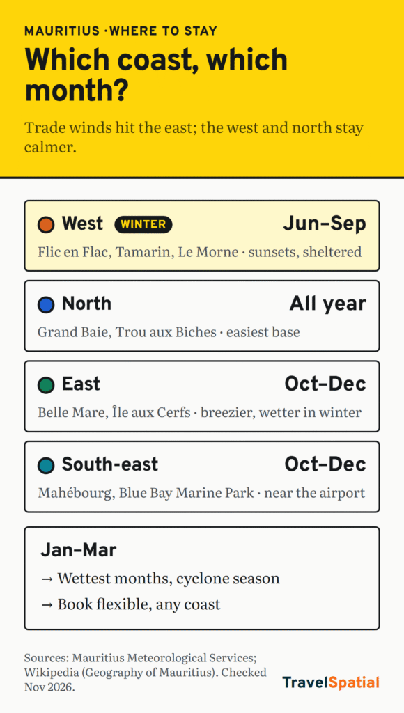
In Mauritius, the side of the island matters more than the hotel. The prevailing trade winds blow onto the east coast, so it’s cooler, breezier and wetter. The west and north coasts sit in their lee: calmer water, drier weather and sunset views. That difference is biggest in the cooler months, from June to September.
So the short answer is: go west or north from June to September, and pick any coast from October to December, which are the driest months. From January to March, the coast matters less than the forecast, because that’s the main cyclone period.
Below, each coast has a short profile and a “pick it if / skip it if” verdict.
The island in one table
| Coast | Main bases | Feels like | Best months | Main trade-off |
|---|---|---|---|---|
| North | Grand Baie, Trou aux Biches | Lively, easy, lots of restaurants | Year-round; calmest Jun–Sep | Busiest coast |
| West | Flic en Flac, Tamarin, Le Morne | Sunsets, sheltered lagoons, surf at Tamarin | Jun–Sep especially | Far from the airport |
| East | Belle Mare, Trou d’Eau Douce, Île aux Cerfs | Long beaches, resort-heavy, breezy | Oct–Dec | Windier and wetter in winter |
| South-east | Mahébourg, Blue Bay | Village life, biggest lagoon, marine park | Oct–Dec | Exposed to the trade winds |
When it’s wet, warm and windy
The Mauritius Meteorological Services splits the year into a warm, humid summer from November to April and a cooler, drier winter from June to September, with May and October as transition months (checked November 2026):
- Warmest: January and February, with average daytime highs of 29.2 °C.
- Coolest: July and August, with average night-time lows of 16.4 °C.
- Wettest: February and March. Driest: October.
- Winter sunshine: above 7.5 hours a day on the coast, but only about 5 hours on the central plateau.
Average island-wide rainfall by month (MMS, 1991–2020 averages):
| Month | Rain (mm) | Month | Rain (mm) |
|---|---|---|---|
| Jan | 280 | Jul | 132 |
| Feb | 322 | Aug | 108 |
| Mar | 294 | Sep | 87 |
| Apr | 206 | Oct | 75 |
| May | 149 | Nov | 85 |
| Jun | 118 | Dec | 164 |
The island-wide averages include the rainy central plateau. Rainfall ranges from about 900 mm a year on the coast to 1,500 mm on the plateau, and tropical cyclones generally occur between January and March (Geography of Mauritius). The trade winds “keep the east side of the island cooler and bring more rain”.
North: Grand Baie and Trou aux Biches
The north is the easy, sociable choice. Grand Baie is the busiest coastal village, with the most restaurants and boat trips. Just down the coast, Trou aux Biches has a two-kilometre white-sand public beach shaded by casuarina trees, and it’s less commercialised than Grand Baie.
- Pick it if: it’s your first visit, you want to walk to dinner, or you’re travelling in winter and want calm water.
- Skip it if: you want empty beaches or a remote resort feel.
West: Flic en Flac, Tamarin and Le Morne
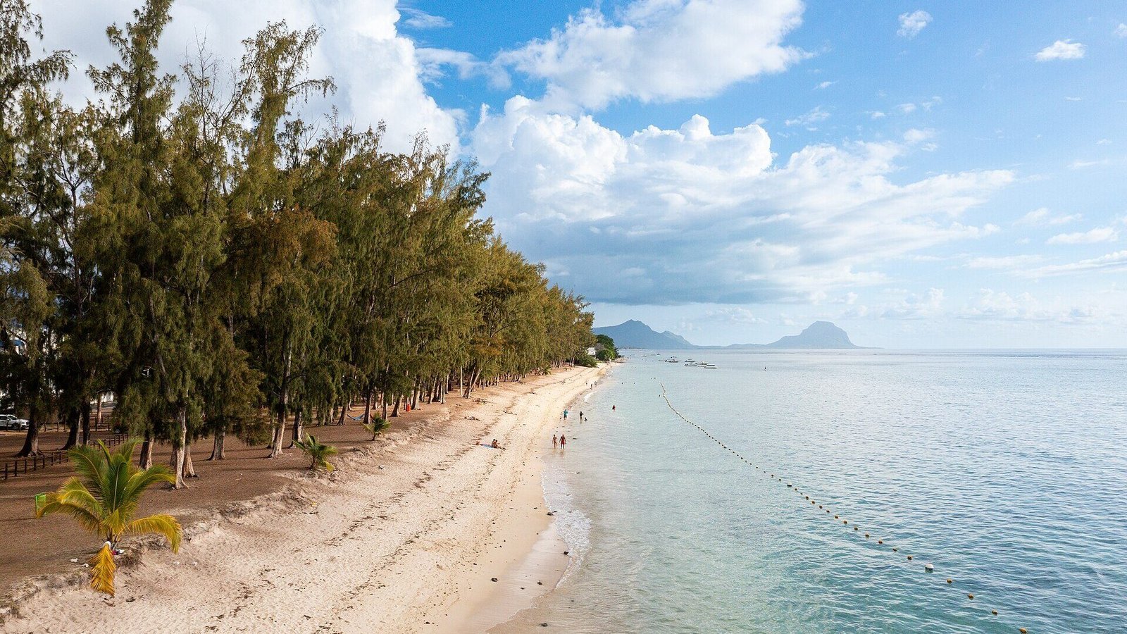
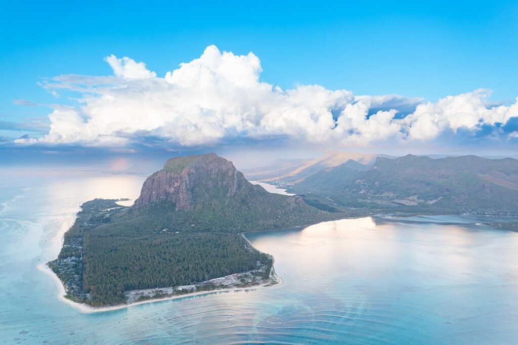
The west is the sunset coast. Flic en Flac has about 13 km of coastline, with a lagoon protected by coral reefs. Tamarin is popular with surfers, and dolphins are seen in Tamarin Bay. At the south-west tip, Le Morne Brabant, a 556 m monolith, was inscribed as a UNESCO World Heritage Site in 2008. It’s a memorial to the escaped slaves who sheltered on it, so treat it as a place of history, not only a photo stop.
- Pick it if: you’re going June–September, want sheltered swimming, or want sunsets over the sea.
- Skip it if: you hate long transfers. Flic en Flac is about 50 km from the airport.
East: Belle Mare and Île aux Cerfs
The east has long beaches and many of the island’s big resorts. Boat trips go out to Île aux Cerfs, a privately owned island off the coast with a golf course. The catch is the wind. This is the coast the trade winds hit first, so it’s breezier, cooler and wetter, especially in winter.
- Pick it if: you’re travelling October–December, want a big resort on a long beach, or find the heat hard to sleep in.
- Skip it if: you’re going in July or August and want still water and guaranteed sun.
South-east: Mahébourg and Blue Bay
The south-east is the most local-feeling coast. Mahébourg is a small village known for the biggest lagoon in Mauritius. Next door, Blue Bay Marine Park protects 353 hectares of lagoon and reef, and it has been a Ramsar wetland of international importance since 2008. It’s also the closest coast to the airport.
- Pick it if: you want snorkelling in a marine park, a village rather than a resort strip, or a short transfer.
- Skip it if: you’re travelling in winter and want calm, warm afternoons. This coast is exposed to the trade winds too.
Getting around
SSR International Airport is at Plaine Magnien in the south-east, 48 km from Port Louis (Wikipedia). Every coast is reachable by road the same day you land, but the west and north are the furthest away, so pre-book the transfer. The Metro Express light rail runs between Port Louis and Curepipe with 22 stations (Wikipedia). It’s useful for the capital and the towns in the middle of the island, but it doesn’t reach the beaches. For those, plan on taxis, a hire car or your hotel’s transfers.
Our tip: split a week between two coasts. Spend three nights on one coast and four on another, for example the south-east near the airport, then the west for sunsets. You’ll see more of the island, and if the wind picks up on one side, you’re not stuck there all week.
Before you go
UK travellers can visit without a visa for up to 60 days. You need a return or onward ticket and must complete the Mauritius All in One travel form before arrival (UK Foreign Office). Other nationalities should check their own rules on our visa map. For when an island is at its best, our shoulder season guide explains how to time trips like this.
The short version
From June to September, stay on the sheltered west (Flic en Flac, Tamarin, Le Morne) or north (Grand Baie, Trou aux Biches) coast. The trade winds make the east and south-east cooler and wetter. From October to December, the driest stretch of the year, the long east-coast beaches and the Blue Bay marine park are at their best. From January to March, cyclone season, choose a flexible booking whichever coast you pick.
Want the next route in your inbox? Join the TravelSpatial newsletter for one mapped itinerary a week.
Sources
- Mauritius Meteorological Services: Climate of Mauritius and Monthly rainfall climatology, checked November 2026
- Wikipedia: Geography of Mauritius (trade winds, coastal vs plateau rain, cyclone months)
- Wikipedia pages for Trou aux Biches, Flic en Flac, Tamarin, Le Morne Brabant, Mahébourg, Blue Bay Marine Park, Île aux Cerfs
- Wikipedia: SSR International Airport and Metro Express
- UK Foreign Office: Mauritius entry requirements
Photo credits
- Flic en Flac Beach in Mauiritius (53697781931) by "dronepicr", CC BY 2.0, via Wikimedia Commons
- Le Morne Peninsula in Mauritius (53697779236) by "dronepicr", CC BY 2.0, via Wikimedia Commons
The infographic is original to TravelSpatial. Photos are used under the licences linked above.